GovTech · Territorial intelligence · since 2004
Intelligence for the public sector.
4DView builds platforms for the public sector, providing the clarity to see, the evidence to decide and a record of what gets done — across every front, from the territory to the decision.
Since 2004 · Sorocaba, Brazil
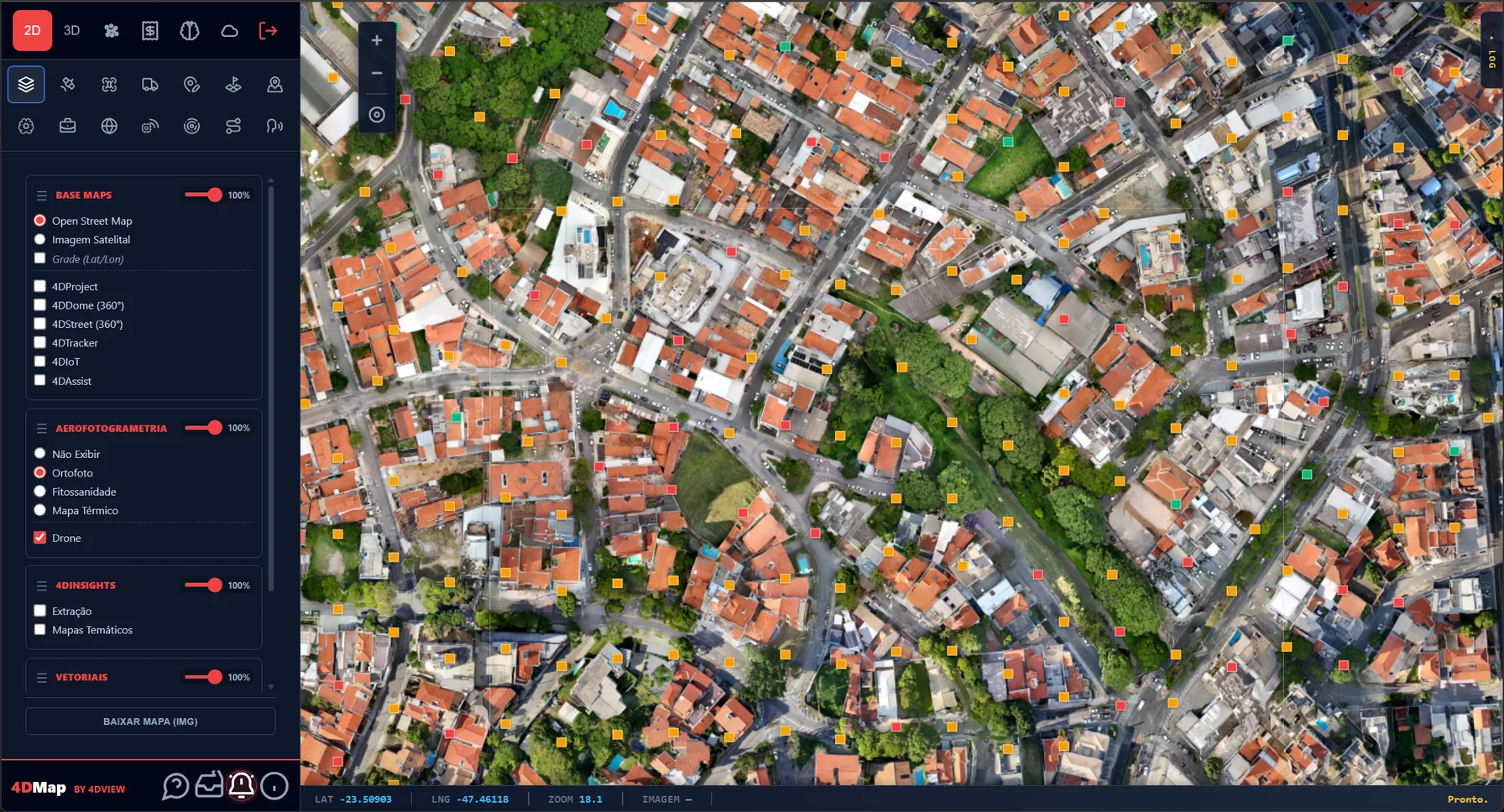
4DMap, where the digital twin supports decisions to govern well and make the most of public resources.
4DMap is 4DView's most complete platform. From field capture — drone, satellite and LiDAR — to the 3D twin, the point cloud and 360°, over a queryable data layer. See the whole city, measure with precision and decide on solid ground.
Capture
Aerial photogrammetry, drone and LiDAR with technical rigor — the faithful portrait of the territory.
Digital twin
Orthophoto, 3D, point cloud and 360°: the territory replicated in data.
Intelligence
GIS, BI and AI in a single layer — data that becomes decisions.
Operation
From analysis to field action, with a record of what was done.
Distinct products, built to the same standard.
The 4DMap is the flagship. Alongside it, a line of independent products — each solves one front of the city, on its own. Where the market stitches together modules of different origins, 4DView builds them all on the same architecture and the same data rigor: they speak the same language and withstand any audit. What unites them is the 4DView DNA — intelligence for the public sector.
ISO 37120 certification · Tourism · Document custody · Education · Healthcare · Citizen · Security · Field — each one an independent platform.
Twenty years ahead.
The company is new; the knowledge behind it is more than twenty years old — from the pioneering GeoXtractor software, back in the 2000s, to today's AI-driven territorial intelligence. It is the rare case of cutting-edge technology that has already had time to mature.
Ready to work beyond Brazil.
Multilingual, standards-based (ISO 37120) and cloud-deployed, 4DView's territorial intelligence can serve a government or organisation abroad without starting from zero — with your data staying under your control.
Let's talk.
Get in touch and we'll set up a meeting to present the platform and explain how we can help your municipality.